

The Good Steward Mapping Tool
The Good Steward Mapping Tool (GSMT) is an online GIS application built for Church of England dioceses. The tool maps all registered church land alongside a wealth of church, heritage, planning and environmental land uses, assisting dioceses to make best use of their land portfolio.
Commissioned by the Archbishops’ Council Housing Project team, and developed by Knight Frank, the tool is used to identify opportunities for new development that respond to housing need in each diocese.
The Coming Home report highlights the complexities of land ownership within the Church of England, involving different parties such as the Church Commissioners, dioceses, parishes, or other church bodies. This often creates a barrier to bringing forward church land for development proactively, in a way that achieves the best strategic, social and environmental benefit.
The GSMT has been developed to provide an in-house tool to help resolve these issues and equip the Church to be good stewards of its land.
Examples of the different kinds of data available:
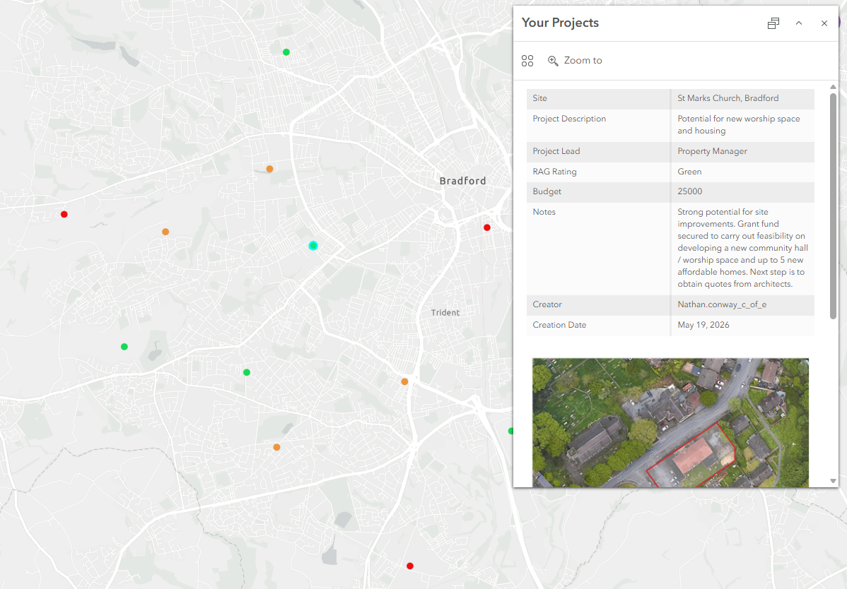
Your Projects
Map and create records for your sites/projects. Provide RAG ratings, project details, filter, add attachments and export data for each of your sites.
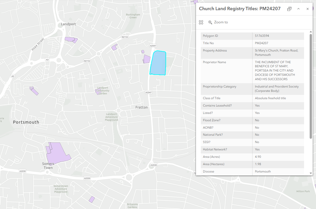
Registered Church Land
All registered church land captured in one place. Search and filter by diocese, parish, title number, site area etc.
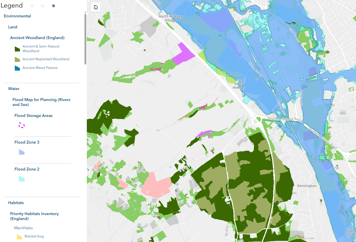
Land Designations
Identify environmental land uses, including flood zones, Priority Habitats, protected woodland, AONBs etc.
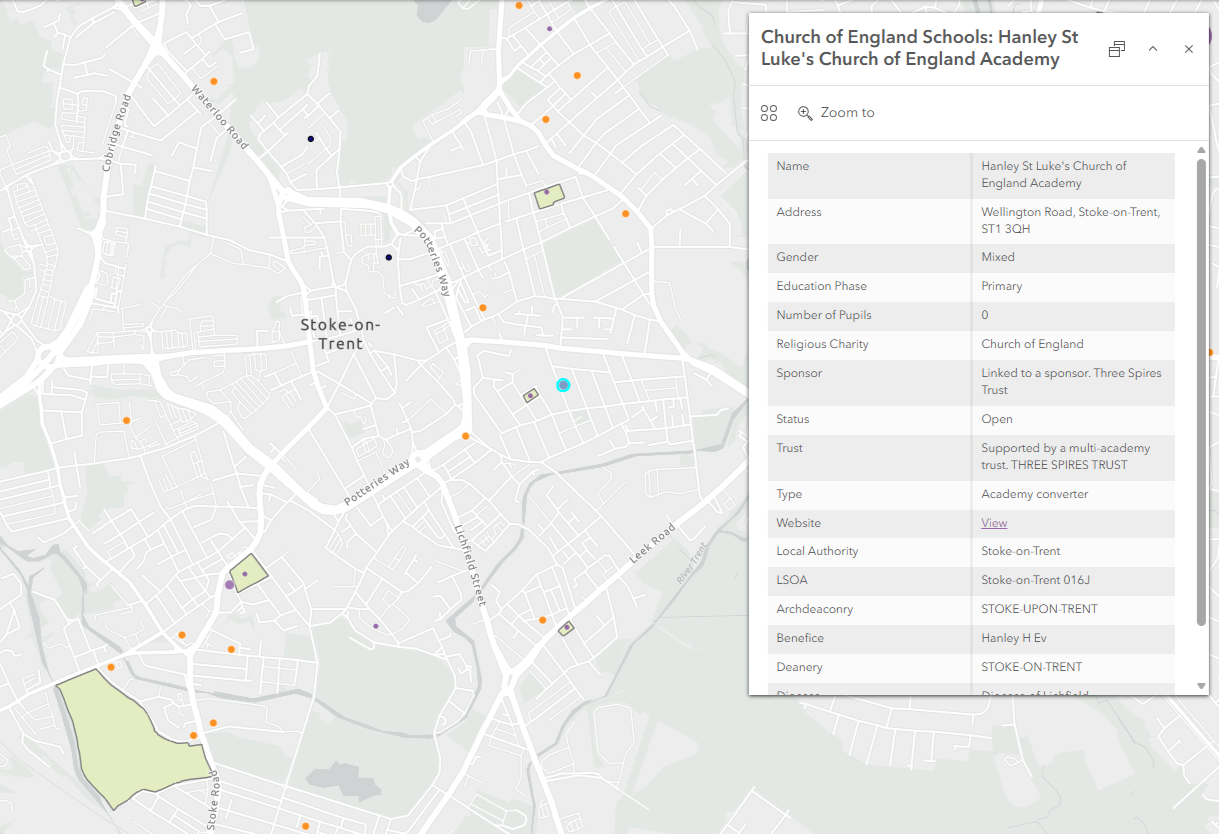
Church Data
See locations and details for all CofE churches, schools and graveyards. View diocesan, archdeaconry and parish boundaries.
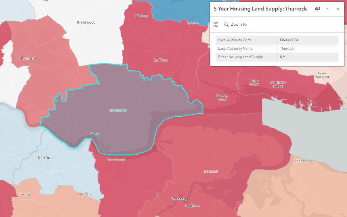
Planning
Use planning data to identify areas of housing need, Local Plan status, Green Belt and areas supported for development by national policy.
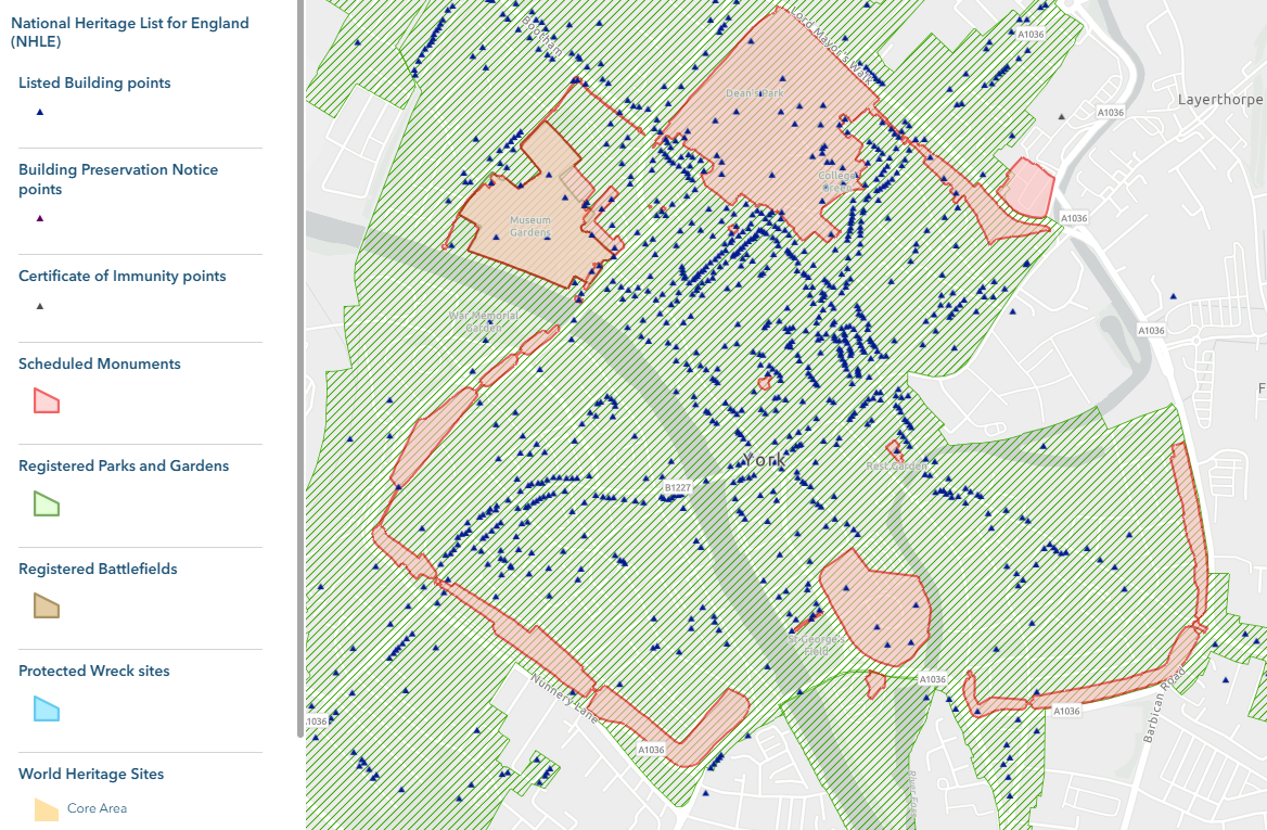
Heritage
Assess impact on heritage assets including listed buildings, conservation areas, scheduled monuments etc. Access Historic England entries for all listed structures.